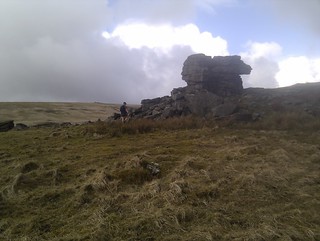
We set off from Sourton and followed the steep path up past the church to join the Dartmoor Way below Sourton Tor. Here we spotted our first Ten Tors group in their traditional spring plumage of massive rucksacks. From here we dropped down to one of my favourite spots, West Okement Valley, and then struggled up to Black Tor. The weather was cold and clear for most of the day but as we headed to High Willhays we entered mist which had settled on the summit.
From here to Amicombe Brook the going was hard with boggy, clumps of grass slowing us down. I did see a nice camp spot for a small tent SX 583861.
After crossing the top of Tavey Cleave we headed back to via Hare Tor and Great Links Tor to Sourton. This side is more popular than the central section, according to Simon this is because sensible people don't like running over trackless boggy ground. Apparently he is not that keen either.
Are we ready for the Cerne Giant 30? Probably not but we will find out on Sunday.
As you can see I have been using Social Hiking a bit. There is a nice feature where you can overlay a route (where you plan to walk) over the top of a track (where you actually walked). I have also found it useful when your phone battery dies halfway through your trip.


Sounds like a great trip. Adding a route to a map is a little known feature of Social Hiking, so thanks for mentioning it! Hoping to head to Dartmoor myself for a week sometime this year. Good luck for Cerne Giant 30!
ReplyDeleteNice write up and I like the addition of a map. Even better, a Social Hiking map.
ReplyDeleteThanks guys, I am using social hiking
ReplyDeletesupposed to say enjoying using sh
Delete